Google Maps update adds deeper Lime integration
After announcing Lime's integration with its Maps app, Google is now bringing even more options to those who are using the bike-sharing service. The latest Google Maps update introduces new features on the “transit” tab, which will allow users to access Lime via both the “walking” and “cycling” tabs as well.
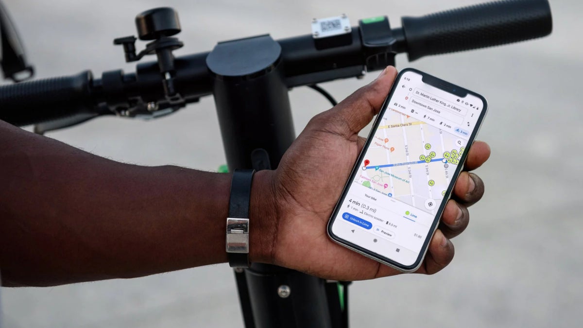
Moreover, Google Maps will show users helpful information about each vehicle including distance, price and battery range, as well as the most efficient walking route to get there. After the latest update, to view Limes from the “cycling” tab in the Google Maps, you will have to enter an origin and a destination then tap the “Lime” sub-tab location on the bottom of the screen.
If there are available scooters and bikes nearby, they will automatically show up on the map, with a walking route displayed to the nearest Lime vehicle and a bicycling route displayed for the rest of the trip.
Also, the “walking” tab will now show users a route using a nearby Lime as an alternative when it's a viable option, along with the estimated travel time. If you don't have the Lime app installed on your phone, clicking the Unlock in Lime button in the Google Maps will direct you to the App Store or Google Play Store.
Currently, Lime is present in more than two dozen cities in the US: Atlanta, Baltimore, Bloomington, Boise, Chicago, Denver, Hoboken, Indianapolis, Little Rock, Los Angeles, Louisville, Miami, Monterey, Mountain View, Oakland, Orlando, Phoenix, Sacramento, San Diego, San Jose, San Marcos, Santa Barbara, Scottsdale, South Bend, Statesboro, Tampa, and Washington DC.

Popular stories


Latest News


Things that are NOT allowed:
To help keep our community safe and free from spam, we apply temporary limits to newly created accounts: