Apple has officially announced the arrival of some great new features to Apple Maps when it launches iOS 15 in 2021. Every year, Apple's direct rival to Google Maps has been getting better and better when it comes to security, simplicity, and easy navigation—and the tech giant has made sure that this year is no exception.
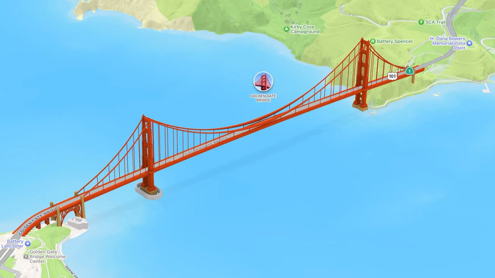
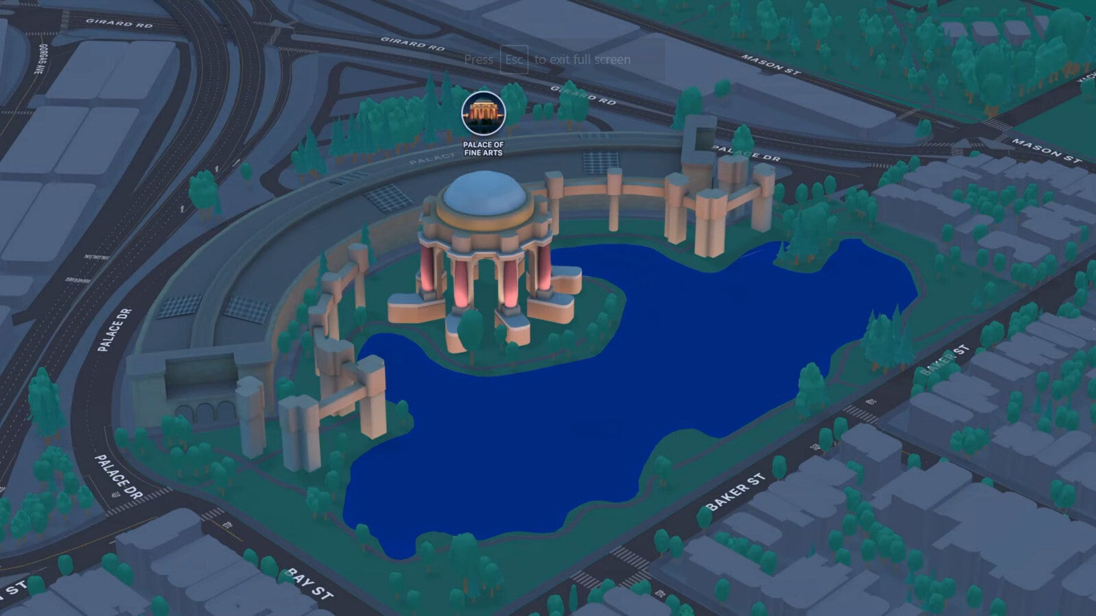
Apple has designed a fresh new approach of exploring the world for those of us that like to virtually globetrot. The company has created a new realistic and interactive globe of the entire Earth, on which you can tap any location and explore to your heart's content.
A Whole New Look
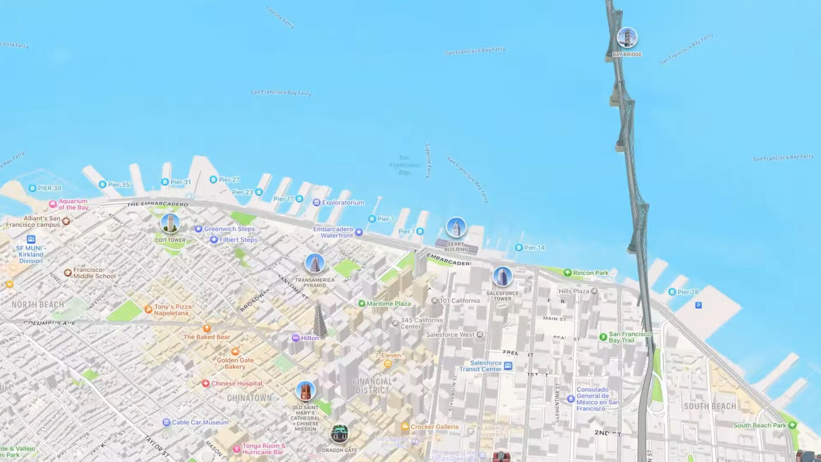
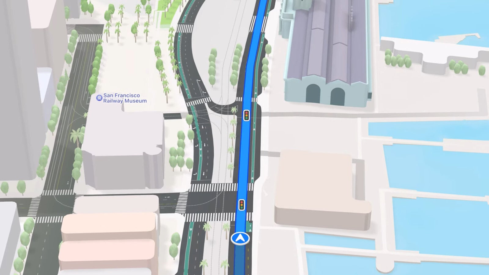
Yet the focus of Apple's Maps update was primarily centered on urban areas, which are receiving incredible new detail in the new software update. For a start, commercial districts, marinas, buildings, as well as other landmarks, are now receiving detailed labels once you zoom in to them enough.
Aside from that, iOS 15 is also bringing clean new labels to the map that show the elevation of a place or landmark.
The roads are seeing a nice color revamp, as well as a new clean look for street names. Apple has also created hundreds of custom-design landmarks, with tiny "profile pictures" popping up above them to let you recognize a landmark as soon as you get close to it, no matter which angle you've got on the map.
Recommended For You
Nighttime Mode
Not only that, but there's a whole new visual mode now available for Apple's virtual Earth: the Nighttime Mode. Activating this will cast the world on your screen in a subtle twilight, with certain landmarks standing out, as well as glowing street names for excellent visibility. It's like a new Dark Mode that's not only easier on the eyes, but also simply beautiful to explore.
Navigation
When it comes to navigation, such as following driving, cycling, or walking directions, iOS 15 is bringing a whole slew of details to the virtual roads, such as streetlights, pedestrian crossings, and street markings (including turn lanes, medians, bus lanes, taxi lanes, bike lanes, and plenty more).
Difficult or large intersections suddenly feel easier to navigate because all the important markings are immediately visible on Apple Maps, even when you can't see them on the road.
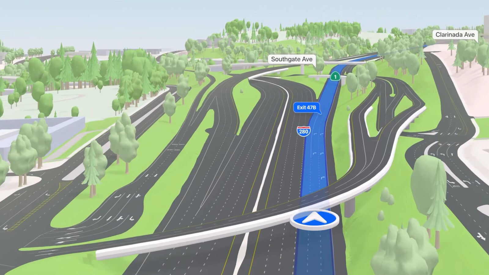
What's even cooler is that when driving on highways, you can now see any overlapping interchanges rendered in a three-dimensional space, so you always know when you will be crossing above or below or approaching a tunnel.
But even when you're crossing under or through something, the navigational marker pointing out your location on the map (which also appears in 3D, by the way) never disappears but stays visible above any closed space you may be in.
But even with all of that detail clearly visible, the map doesn't look or feel crowded, but still manages to look extremely clean and somehow even more aesthetic.
Apple tells us that all these new driving navigation improvements will be here to make our lives easier later this year.
Public Transit
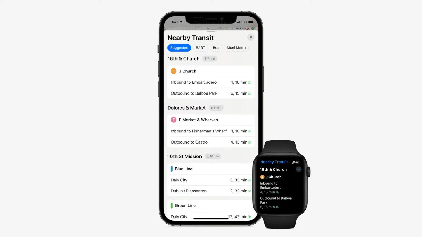
Traveling by bus in the city will also be even easier than ever now, especially in cities where you may not be so well familiar with where all the stops are, and which direction they take.
You can now easily view and look over nearby bus stop information through your phone, and you can pin the ones you use most often to the top for immediate access. Perhaps best of all for Apple watch owners, all this information will also appear on your watch so you can track city buses without even taking out your phone.
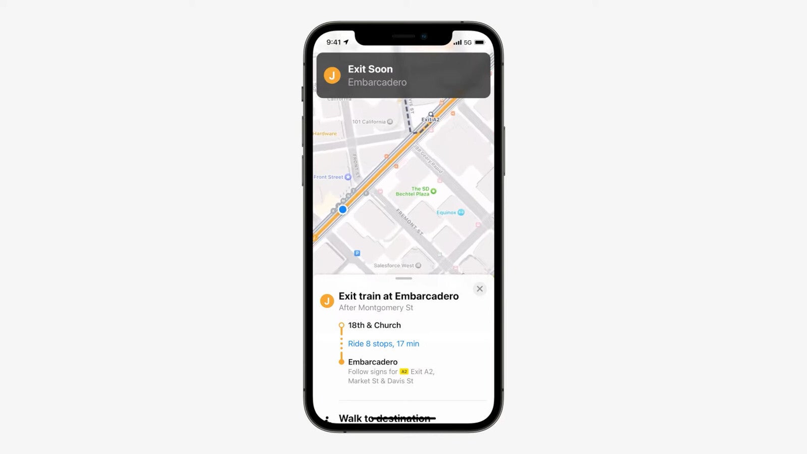
If you're already traveling on a bus and nearing your destination, Apple has added an incredibly useful feature that displays a pop-up whenever you are nearing your final stop, to let you know to prepare for getting off soon. (This may be more useful than it sounds for some of us absent-minded people who often travel with our head in the clouds!)
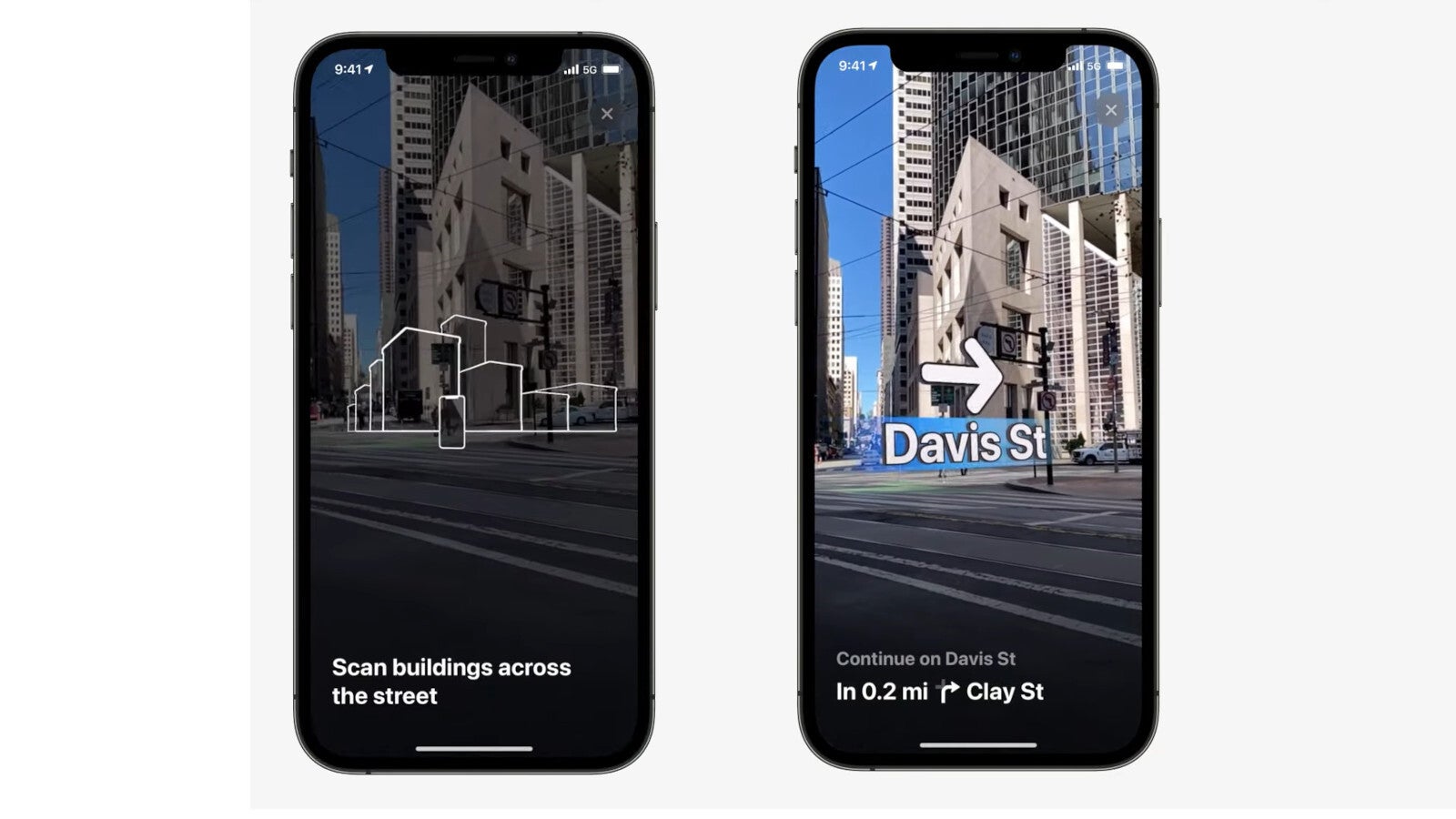
Navigation will also now be super easy even if you disembark in the middle of a highly crowded street, where the GPS signal can become confused and unable to pinpoint your exact location and direction.
Apple has brilliantly solved this by allowing you to scan the buildings around you with your iPhone, so it will be able to leverage your 3D surroundings to figure out exactly where you are. Once it does, it will provide augmented-reality directions with maximal detail, telling you where to go no matter how clustered the surroundings may be.
Apple promises this 3D urban navigation experience will be fully available by the end of this year in the following cities:
London
Los Angeles
New York
Philadelphia
San Diego
San Francisco Bay Area
Washington, DC
Apple has also announced that the Maps app will expand its user base to include Spain and Portugal (starting June 7), and Italy and Australia (later this year)—although these and many other countries will have to wait a bit longer before they can enjoy 3D city navigation and other new features.
Six-month unlimited plan is now 57% off
$90
$210
$120 off (57%)
Mint Mobile is now allowing you to get whichever plan you like for either three, six, or 12 months for just $15/mo. If you go for the six-month unlimited service, for instance, you'll now have to pay just $90 upfront instead of $210.
A discussion is a place, where people can voice their opinion, no matter if it
is positive, neutral or negative. However, when posting, one must stay true to the topic, and not just share some
random thoughts, which are not directly related to the matter.
Things that are NOT allowed:
Off-topic talk - you must stick to the subject of discussion
Offensive, hate speech - if you want to say something, say it politely
Spam/Advertisements - these posts are deleted
Multiple accounts - one person can have only one account
Impersonations and offensive nicknames - these accounts get banned
To help keep our community safe and free from spam, we apply temporary limits to newly created accounts:
New accounts created within the last 24 hours may experience restrictions on how frequently they can
post or comment.
These limits are in place as a precaution and will automatically lift.
Moderation is done by humans. We try to be as objective as possible and moderate with zero bias. If you think a
post should be moderated - please, report it.
Have a question about the rules or why you have been moderated/limited/banned? Please,
contact us.


![Verizon denies SpaceX is buying it [UPDATED]](https://m-cdn.phonearena.com/images/article/182254-wide-two_350/Verizon-denies-SpaceX-is-buying-it-UPDATED.webp)


Things that are NOT allowed:
To help keep our community safe and free from spam, we apply temporary limits to newly created accounts: