Google’s new experiment "Land Lines" turns your scribbles into mesmerizing satellite imagery
Either way, Google’s latest Chrome Experiment is called “Land Lines” and it is an exercise in recognizing visual input and matching it with patterns from satellite imagery. Or, in other words, you doodle stuff on your phone’s touch screen and then “Land Lines” matches it with lines and shapes from satellite photos. It could be a winding river bed, or the snow-clad ridges of a mountain range, or simply a turn on a road junction. To achieve this, Google uses machine learning (big surprise, huh?) and through thousands of data entries stored in “vantage point threes” to match your doodle with something on Google Earth. Cool, huh? Well, that’s just the “Draw” mode in “Land Lines”.
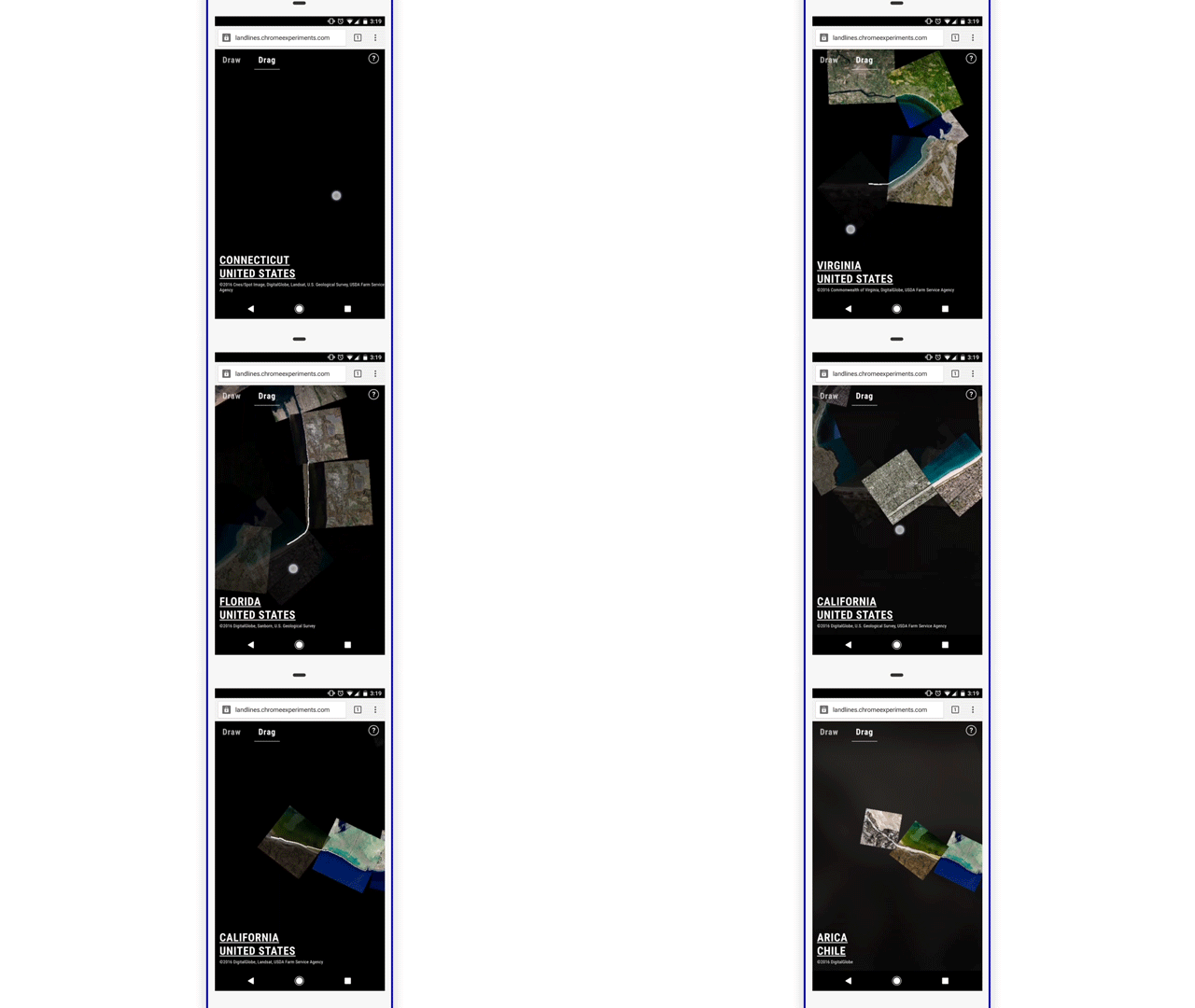
Exploring Planet Earth at high speeds
The other mode is called “Drag” and uses similar real-time analysis mechanics to match your input with something from Google Earth. However, in this mode, “Land Lines” assembles courses made up from smaller frames of satellite photos and joined together by way of interconnected highways, rivers, coastlines, and other geological or man-made formations. As you drag your finger along the screen, a fast, continuous line follows the “track” created by these interconnected shapes as new frames fall to place on its way as you go along.


source: Google
Follow us on Google News






Things that are NOT allowed:
To help keep our community safe and free from spam, we apply temporary limits to newly created accounts: