How traffic on Google Maps was faked with a bunch of phones

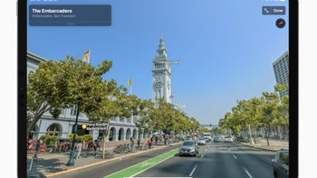
One of the benefits of having a service as dominant as Google’s is that the massive amount of user data can be used for some handy features that benefit us all. Such is the case with Google Maps. Beyond all the restaurants and other points of interest you can find on there, one vital feature Maps offers is traffic information.
Knowing in advance which streets are busy can not only save you time on your daily commute but can help you catch a flight or not miss an important meeting. The way Google gathers traffic data is through devices that use Google Maps. Through location services, Google knows where and how fast people are moving. A bunch of smartphones slowly moving on a street? That’s a traffic jam right there! Or is it?
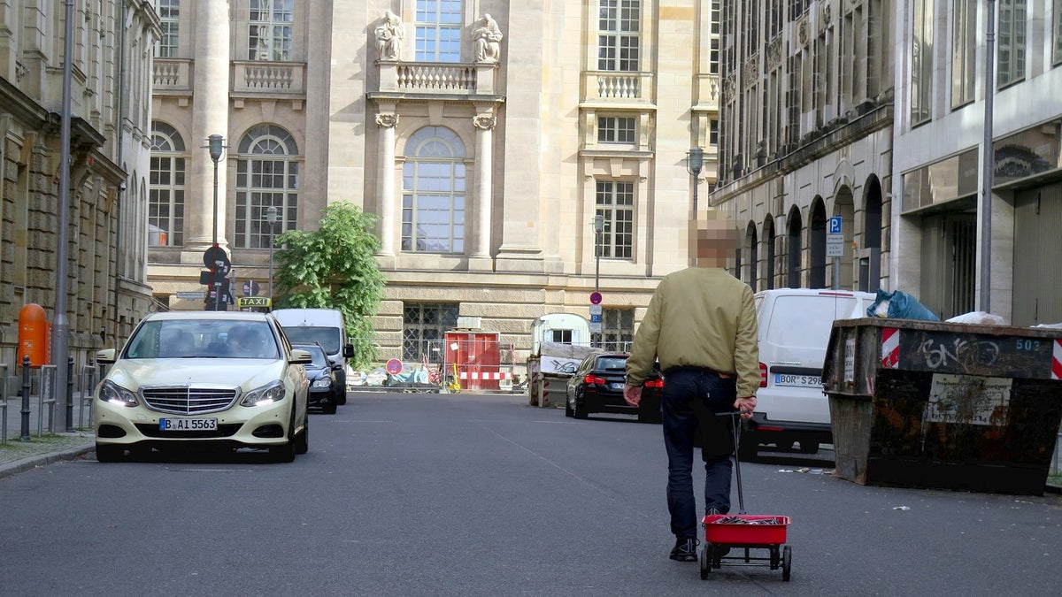
Not in one particular case, it’s not. Simon Weckert, a German artist that focuses on technology-related projects, decided to perform a small experiment. He bought 99 used smartphones, turned on Google Maps on each of them, loaded them in a handcart and hit the streets.
The goal was simple: see if his lonely cart can make an empty street show as a traffic-packed road on Google Maps. The results can be seen in the video below.
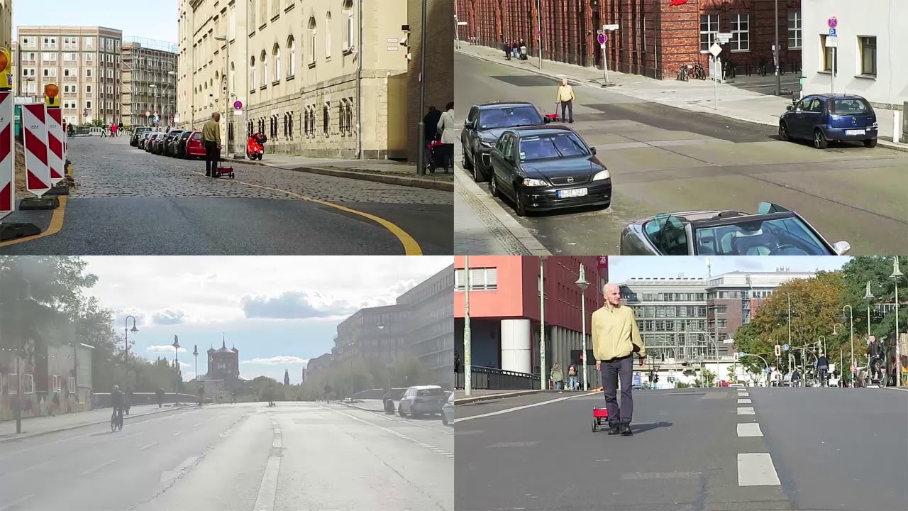
Assuming no foul play was involved in this project, the concept worked as expected. Not long after the cart enters a street, its color on Google Maps changes from green to red, signaling users to avoid it.
While it’s unlikely that someone would abuse this mechanic, with the attention Simon’s stunt has gathered, Google might make some tweaks to its algorithms to ignore data from devices that are too close to each other.
Still, it was cool to see something many have probably thought about put to the test. And with no harm being done, we can only applaud the effort.
Knowing in advance which streets are busy can not only save you time on your daily commute but can help you catch a flight or not miss an important meeting. The way Google gathers traffic data is through devices that use Google Maps. Through location services, Google knows where and how fast people are moving. A bunch of smartphones slowly moving on a street? That’s a traffic jam right there! Or is it?
Not in one particular case, it’s not. Simon Weckert, a German artist that focuses on technology-related projects, decided to perform a small experiment. He bought 99 used smartphones, turned on Google Maps on each of them, loaded them in a handcart and hit the streets.
The goal was simple: see if his lonely cart can make an empty street show as a traffic-packed road on Google Maps. The results can be seen in the video below.
Assuming no foul play was involved in this project, the concept worked as expected. Not long after the cart enters a street, its color on Google Maps changes from green to red, signaling users to avoid it.
While it’s unlikely that someone would abuse this mechanic, with the attention Simon’s stunt has gathered, Google might make some tweaks to its algorithms to ignore data from devices that are too close to each other.
Still, it was cool to see something many have probably thought about put to the test. And with no harm being done, we can only applaud the effort.

Popular stories


Latest News


Things that are NOT allowed:
To help keep our community safe and free from spam, we apply temporary limits to newly created accounts: